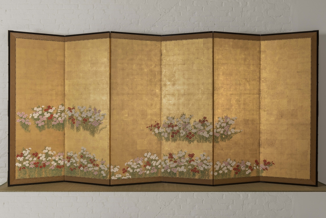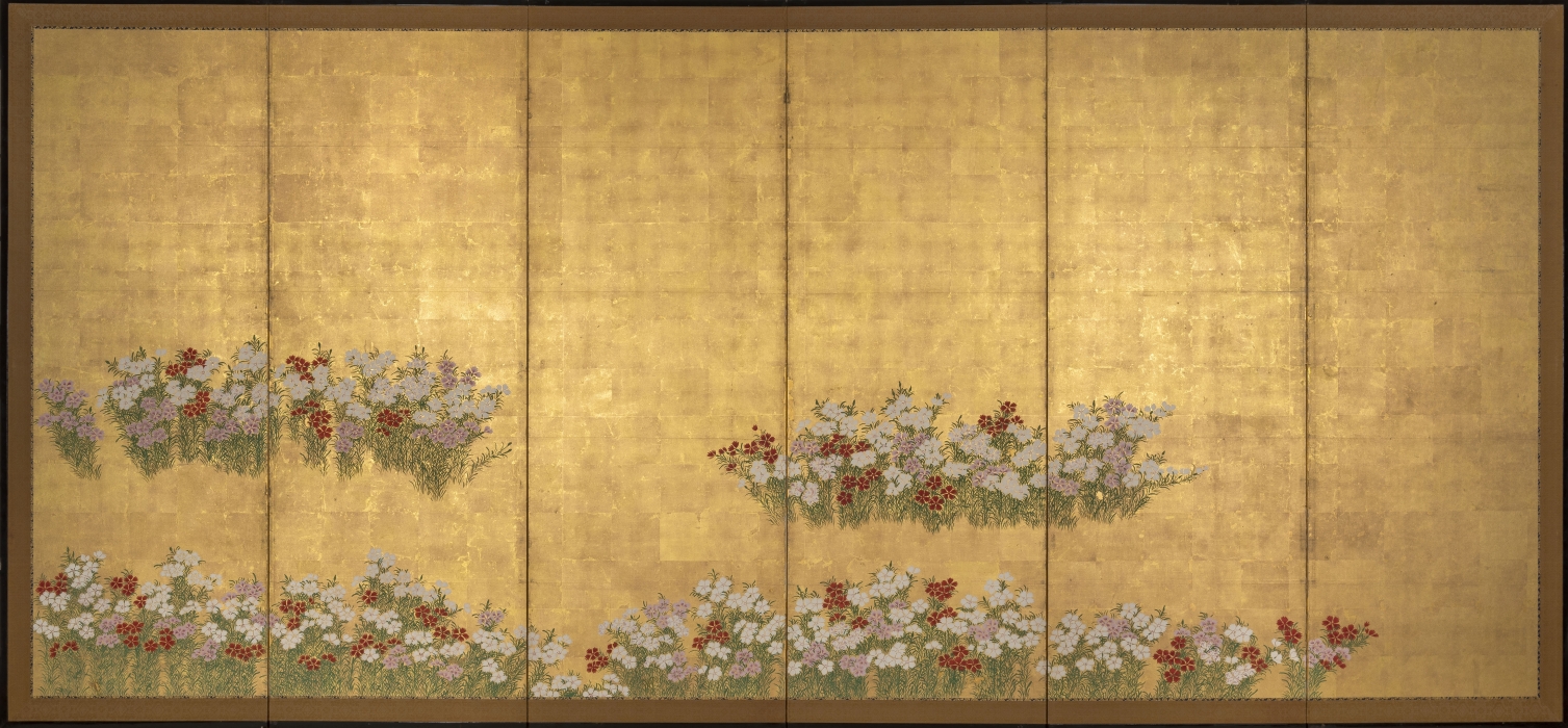


Product Description
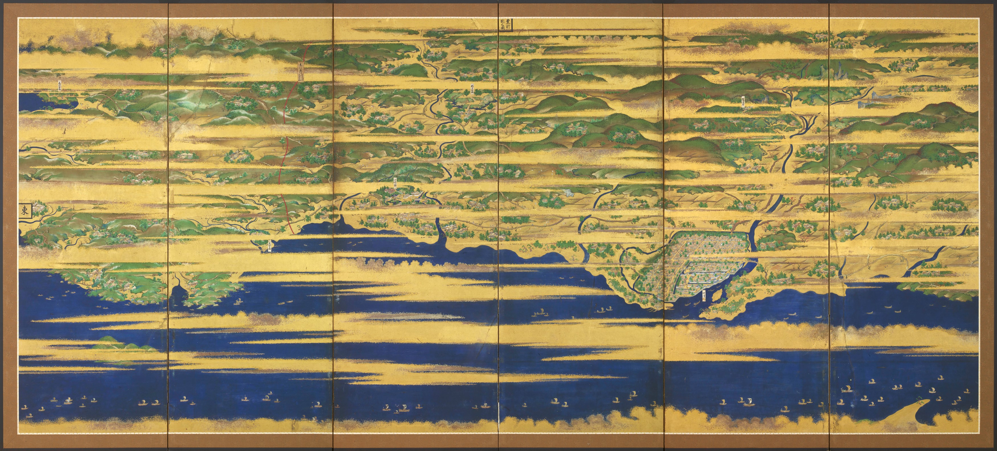
7591 A six-fold paper screen painted in ink, colour, gold and silver with a map of Buzen and Bungo provinces, depicting numerous figures and ships at sea amongst golden clouds
Tosa School, circa 1621-1632, Edo period, Japan
Titled: Buzen no kuni no zu (Picture of the Buzen Province)
Dimensions: H. 177.5cm x W. 387.5cm (70” x 152¾”)
Provenance: most likely commissioned by Hosokawa Tadaoki (1563-1646), daimyo (feudal lord) of Buzen and Bungo provinces from 1600 to 1632.
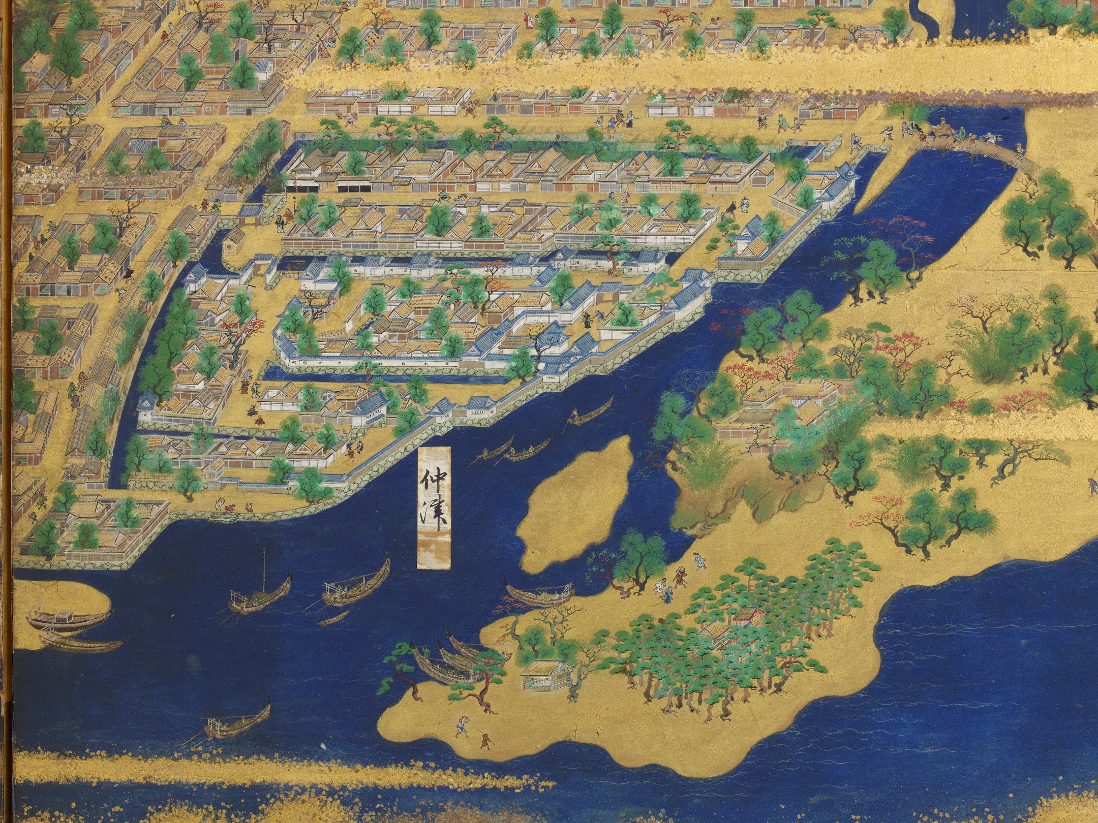
This panoramic, bird’s-eye view of Buzen and Bungo provinces (modern day Oita and Fukuoka prefectures) in northern Kyushu shows a map of the area, part of the Seto Inland Sea as well as various genre scenes minutely detailing local people’s life in the early 17th century. When read from the right as tradition dictates, the screen’s title Buzen no kuni no zu (Picture of Buzen Province) appears at the top of the third panel and the direction Higashi (East) is indicated to the far left of the screen.
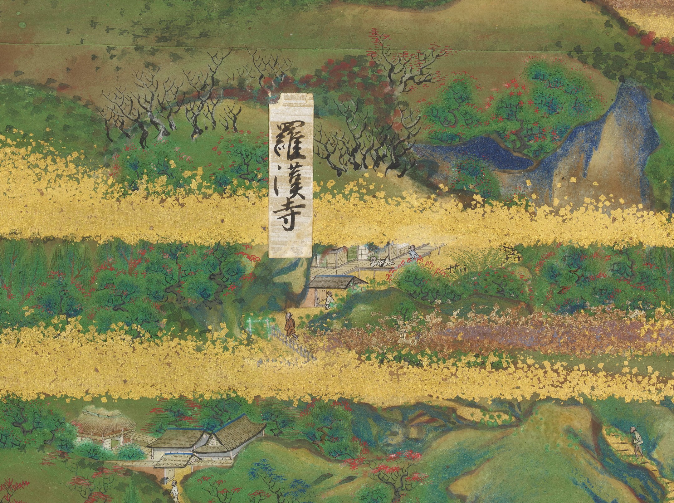
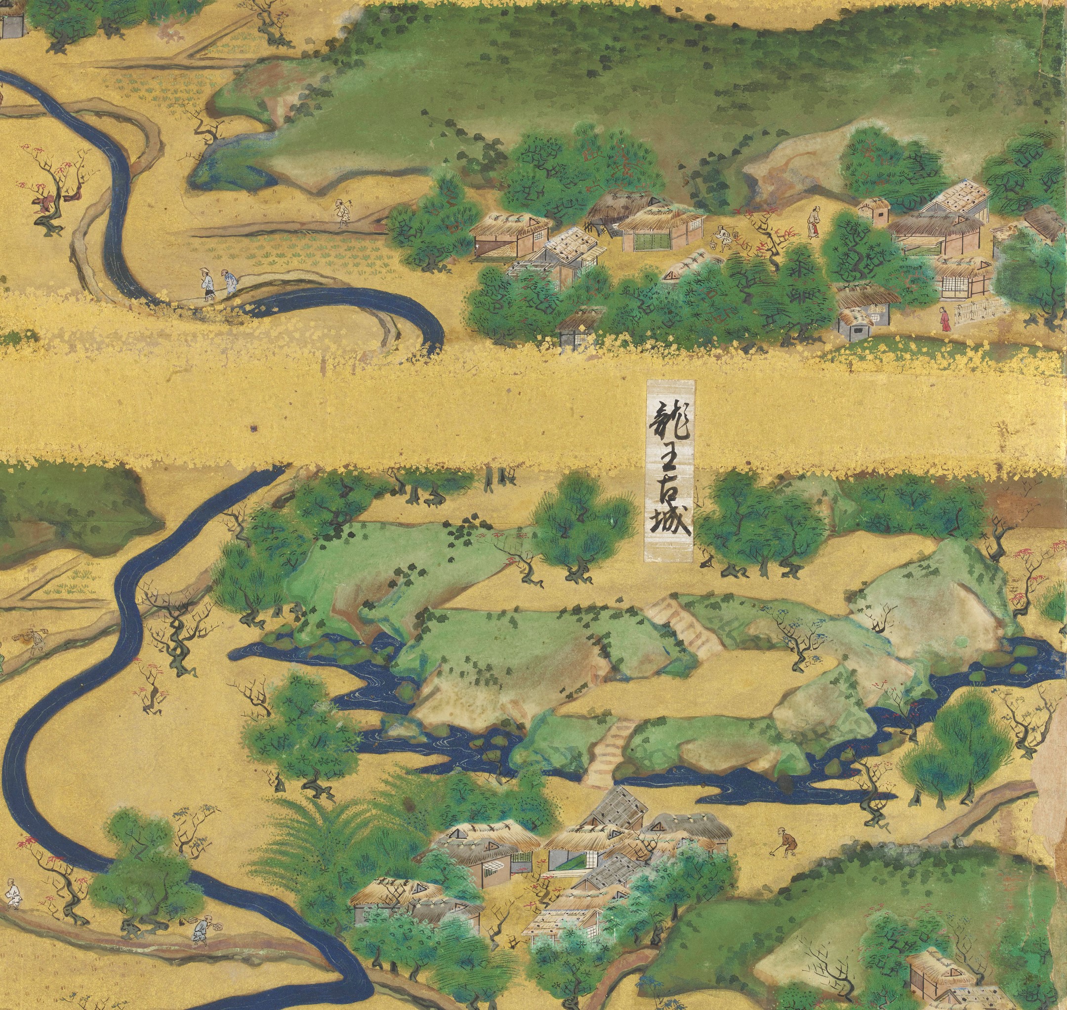
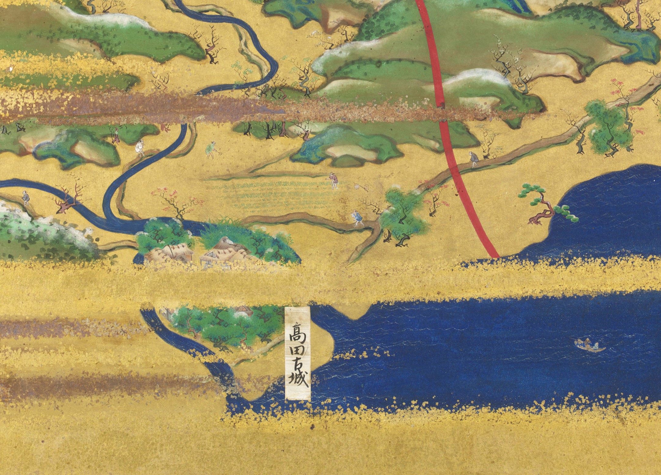
Numerous paper labels indicate important places and landmarks such as castles, a Buddhist temple and a Shinto shrine.
2nd panel: Rakanji temple and Nakatsu
4th panel: Ryuo-kojo (old Ryuo castle) and Usahachiman shrine
5th panel: Shubiki kokkyo migi Buzen hidari Bungo (red-lined boarder, Buzen on the right, Bungo on the left)
6th panel: Kitsuki-kojo (old Kitsuki castle)
Particular attention is given to Nakatsu castle and jokamachi (castle town) that are precisely depicted in the lower part of the 2nd and 3rd panels including stone walls, moats and yagura (turrets and watch towers) all of which show the exact locations and forms of these structures at the time. Samurai warriors holding katana (swords) and yari (shafts) are strolling inside the castle walls and some are guarding the houses within the grid-planned castle town. A record indicates that the Tenshu (keep tower) of Nakatsu castle was destroyed in 1621. Since no Tenshu or high tower is visible within the castle, this screen was most probably painted after this date. One more clue in dating this screen is the lack of Koiwai Island, a large land mass which was formed in the Nakatsu area after the great flood of 1669.
All other castles are indicated as kojo (“old” castles), which suggests they had been abolished due to a ruling known as Ikkoku-ichijo rei (law of one castle per province). This law enforced by the Edo bakufu (feudal government) in 1615 restricted each feudal domain to just one castle. One of these abolished castles, Kitsuke castle depicted on the far left panel, became an official and valid castle again in 1632 with a new feudal lord Ogasawara Tadatomo (1599-1663), again suggesting a pre 1632 date for this screen.
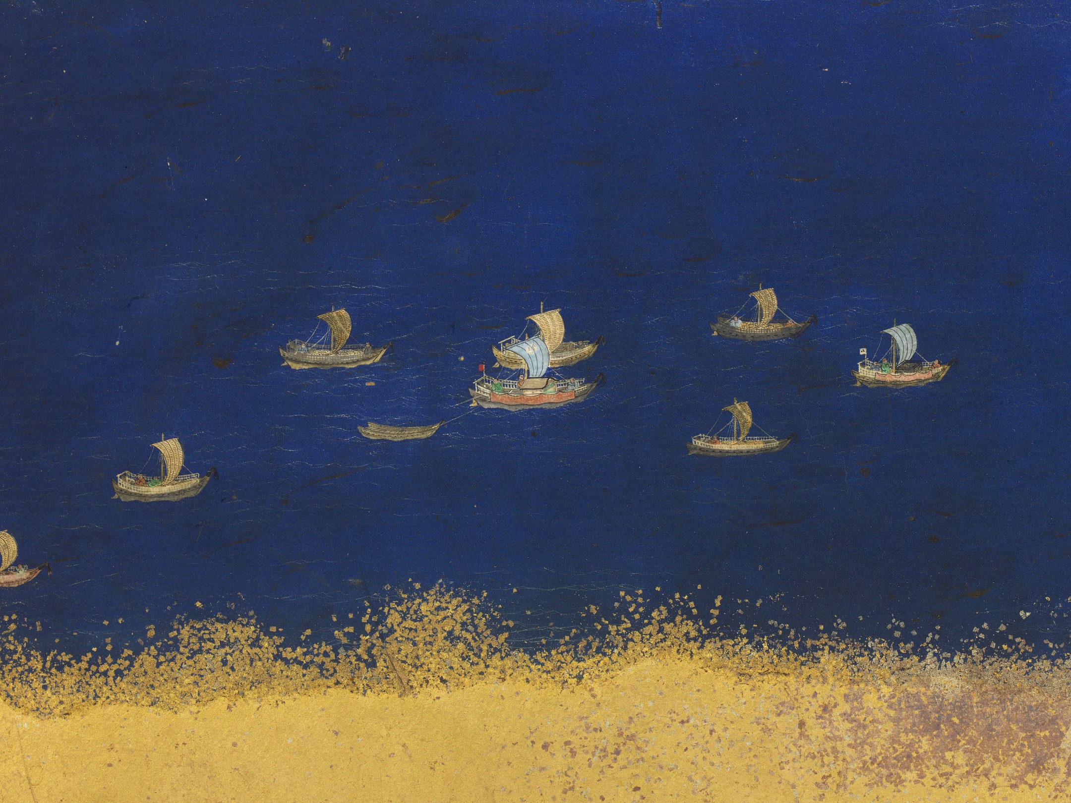
The iconography used here can determine the date of the screen as it would have been intended as a literal representation of the primary sites of the area, portraying buildings which were extant at the time the screen was created. The only daimyo to own the Nakatsu castle as well as the entire area depicted in this screen, including the old Kitsuke castle in Bungo province, was Hosokawa Tadaoki (1563-1646). Interestingly the mon (family crests) shown on the sails of the vessels at sea are of daimyo associated to this area. They include the Kuyo mon (nine-star crest) of the Hosokawa family and the Fuji-tomoe mon (swirling wisteria crest) of the Kuroda family (the previous daimyo of Buzen province). However, there are no crests relating to daimyo who governed this area after the Hosokawa family. Hosokawa Tadaoki left the Buzen/Bungo area in 1632 when he gained a new appointment to govern Higo province which is now known as Kumamoto prefecture.
Not only the Nakatsu castle, but also some other buildings such as Rakanji temple and Usahachiman shrine still exist today. In these religious compounds, monks, kannushi (“god master” or Shinto priests) and pilgrims are finely rendered in great detail with one even shown taking a nap on the engawa (verandah) of the temple.
The natural landscape is also painted with great precision depicting mountains and rivers of the surrounding area. One easily identifiable spot is Yabakei gorge, with its iconic rocky walls, illustrated in the upper part of the 1st and 2nd panels from the right. The seasons are also shown with autumn on the right half of the screen represented by scenes of harvesting and trees with coloured leaves, and winter on the left, with snow covered mountains, houses and trees. Each house and hut is individual, having different structures, roof materials (tiled, thatched or wooden), window shapes, walls, etc. On the sea, numerous sail boats are visible amongst waves, carrying both people and cargo.
The amount of detail depicted in this screen gives us a valuable insight to the daily life of the local people who are meticulously represented: farmers harvesting, threshing grain and herding cattle, fishermen beside the sea, samurai, pilgrims, a man pounding mochi (rice cake), a mother comforting her infant and children playing whilst making a large snow ball etc. Various people full of character enjoying their everyday lives in the villages give life to this spectacular map landscape.
This screen follows the popular tradition of screens known as Rakuchu rakugai zu (views in and around the capital) depicting the panoramic views of Kyoto, the capital of Japan from c.792 to c.1868. However, it is rare to find map screens of this kind, relating to places other than Kyoto, especially with this level of precision and quality. The Hosokawa family were awarded the fief of Buzen and Bungo in the early 17th century and are known to have retained Tosa-school artists, a school renowned for its delicate and detailed painting style.
It is highly likely that originally this screen was one of a pair (left hand side) and there was another screen which possibly depicted the northern part of Buzen with Ogura castle which was also part of the Hosokawa Tadaoki fiefdom.